Hiking on Monte Baldo from Brenzone
Trails for all levels among alpine views, huts and wild nature
Monte Baldo offers a network of trails suitable for hikers of all levels, with ever-changing scenery, slopes, and environments. A detailed hiking map with the various types of trails is available at the Tourist Office.
Below are the main types of routes:
With less than 250 meters of elevation gain, these trails follow grassy ridges and light woodlands, perfect for those seeking a relaxing walk with views over Lake Garda. Many start from the top station of the cable car.
These connect mountain hamlets with alpine huts and refreshment points. A good example is the loop trail from Prada to Malga Valvaccara and back. Average length: 5-10 km, ideal for those with a steady pace but little technical experience.
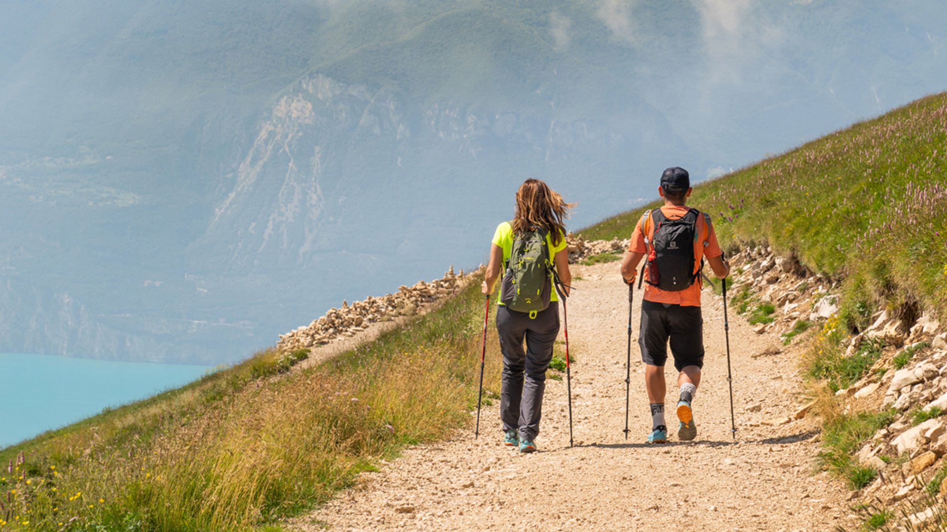
Routes that follow Monte Baldo’s main ridges, such as itinerary CAI 651 to Cima Costabella or Cima Pozzette, feature steeper climbs (500–700 m of elevation gain) and rocky terrain. Recommended for well-trained hikers, they offer sweeping views and constantly changing landscapes.
The “sentiero natura” trail connects botanical and historical points of interest over about 7 km, passing through beech woods, flowering meadows, and alpine pastures. Ideal for those who wish to explore diverse environments.
More demanding itineraries follow the entire Monte Baldo ridge from north to south, passing Bocca di Navene and Cima Valdritta. These longer routes (over 10 km, with up to 800 m of elevation gain) are for experienced hikers seeking a full-day adventure.
Those staying in Brenzone can choose between an easy walk, a half-day outing, or a more challenging high-altitude experience.
Monte Baldo’s trail network offers a real opportunity to get to know the mountain, moving between water, forest, alpine heights, and ever-changing landscapes.